Detector layout files
Detector boards with circuit diagrams, board layout and bill of materials (eagle.sch, eagle.brd, gerber, exel format)
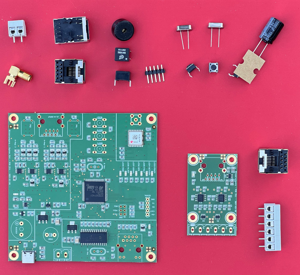
Some notes on the Blue Basic detectors with the PCB 22.x boards:
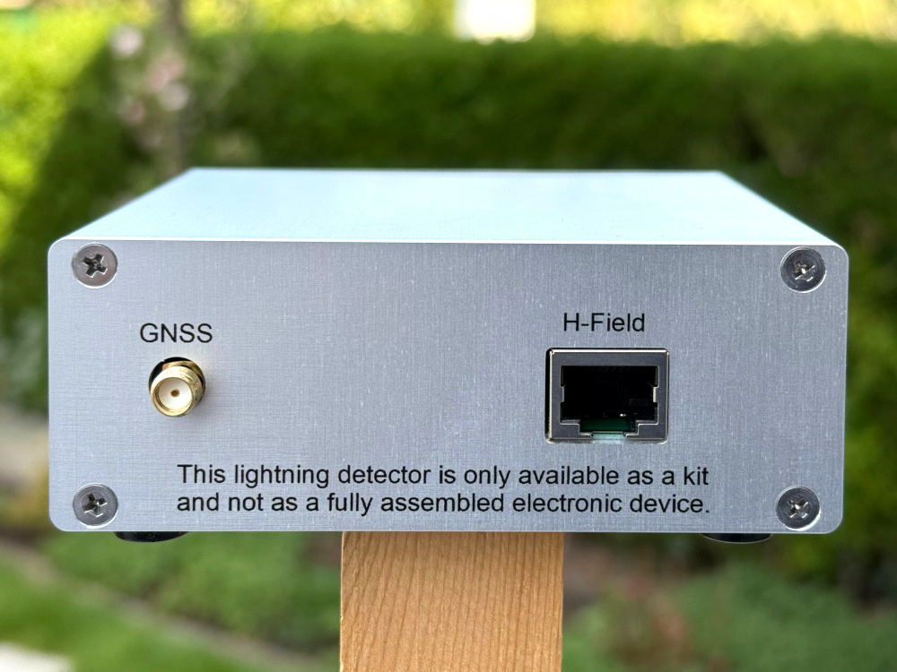
- The RJ-45 HanRun socket with the LEDs is the socket for the Ethernet connection to the router. The other RJ-45 socket without the LEDs is the socket for the connection to the preamplifier. Please do not swap the connections. This may cause a defect in the LP5907MFX-4.5NPB / IC503 voltage regulator on PCB 22.0/1/2.
- The C500 electrolytic capacitor (560µF – 1000µF) is only necessary if you're using a dirty power supply or if the board is powered via the terminal block. Do not solder this capacitor if you're using a smart USB-C power supply, such as those used to charge laptops. These power supplies can classify the detector as a voltage source if there's a residual voltage on the capacitor.
- If you cannot find the detectors IP in your router (look for “blitzortung”), then you can also get the last number of the IP V4 address acoustically, see the documentation.
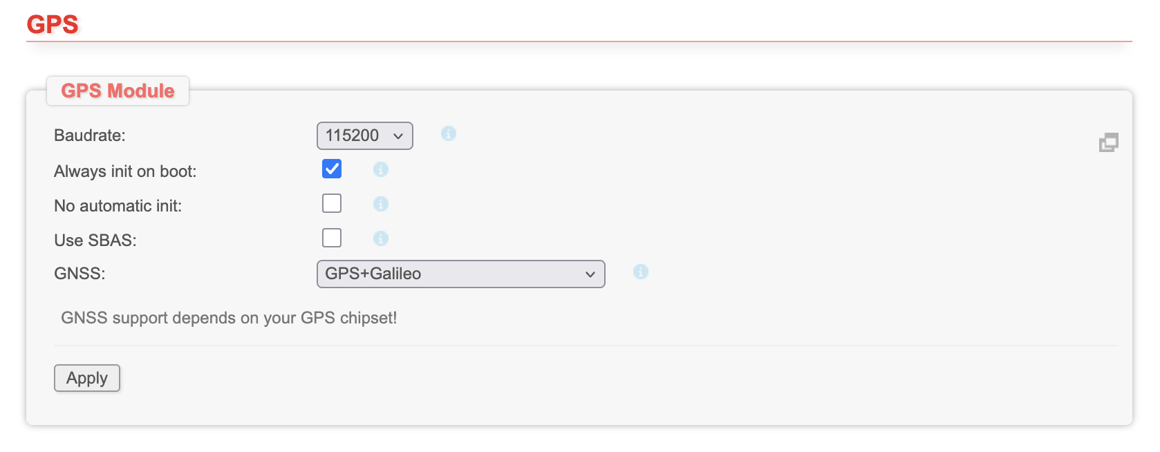
- On the webpage of the Firmware you should set the GNSS type in the "Settings -> GPS" field to "GPS+Galileo". The Baudrate will change to 115200.
- If you have one of the test boards 22.0/1, then please do not change the jumper settings, these are for selecting different power supply options for some components and for the coding of the board.
- The link for creating an account at blitzortung.org is above on the first page of the firmware. This link is only shown, if the station is not already assigned to a user.

- You will find the Device-ID of the detector in the "Status -> Controller /CPU" field. With this ID you can assign the detector to your user account on blitzortung.org "Project Area -> user data". The minus signs can be omitted.

- It could be that the assignment of the detector to the regions is not correct, because the boards were initially already online in Europe for the initial firmware programming. Please contact me in these cases (blitzortung@gmx.org) if the regions do not change automatically.
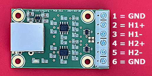
The H-field preamplifier PCB 23.1 has 6 input pins. The two outer pins, pin 1 and pin 6, are ground. They can be used for shielding antennas. Pin 2 and 3 is the first amplifier input, pin 4 and 5 is the second amplifier input. Enclosures:
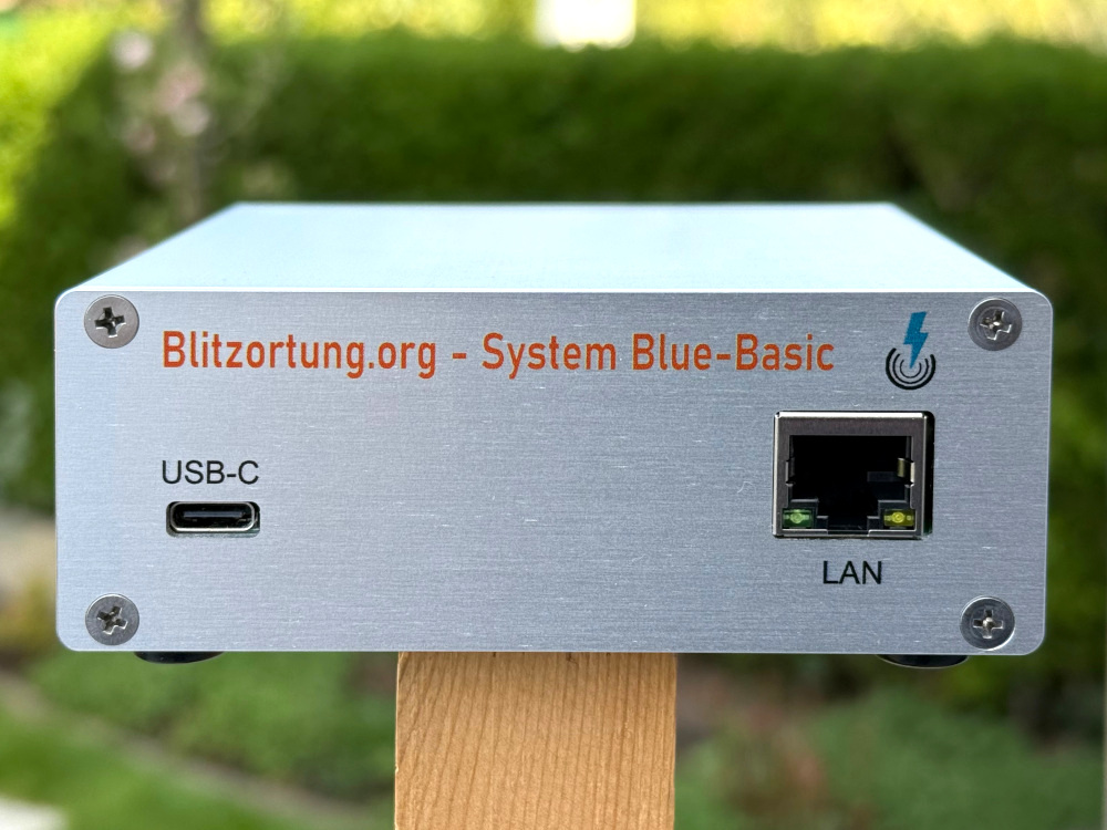
The PCB 22.x boards have dimensions of 100 mm x 100 mm and can therefore be easily installed in standard enclosures. For the profile enclosures from fischer elektronik, which are assembled from the two housing shells KOH 1 100 (100 mm x 105 mm x 16.9 mm) and KOH 2 100 (100 mm x 105 mm x 22 mm), we offer prefabricated front panels and back panels in the size of 100 mm x 38.9 mm.


Our OpenStreetMap vector MBTiles collections
The following mbtiles files are generated by "Tilemaker", see also "... a way to generate a .mbtiles file from .osm.pbf file". The OpenStreetMaps pbf files are downloaded from Geofabrik. Due to time constraints, we only update our mbtiles files once a year.
- changes to the config file "config-openmaptiles.json":
for "water" and "landuse", the minimum zoom range has been extended by
{ "minzoom": 0 }
- changes to the process file "process-openmaptiles.lua":
the language support has been expanded by
additional_languages = { "am", "ar", "az", "be", "bg", "br", "bs", "ca", "co", "cs", "cy", "da", "de", "el", "en", "eo", "es", "et", "eu", "fi", "fr", "fy", "ga", "gd", "he", "hi", "hr", "hu", "hy", "id", "is", "it", "ja", "ja_kana", "ja_rm", "ja-Latn", "ja-Hira", "ka", "kk", "kn", "ko", "ko-Latn", "ku", "la", "lb", "lt", "lv", "mk", "mt", "ml", "nl", "no", "oc", "pl", "pt", "rm", "ro", "ru", "sk", "sl", "sq", "sr", "sr-Latn", "sv", "ta", "te", "th", "tr", "uk", "zh" };
- Attribution: © OpenMapTiles © OpenStreetMap contributors
- License: CC-BY-SA
| region | sources | targets | ||
| Planet | [.pbf] | (82.7 GB) | [.mbtiles] | (128 GB) |
| Afrika | [.pbf] | (7.07 GB) | [.mbtiles] | (9.59 GB) |
| Antarctica | [.pbf] | (33.0 MB) | [.mbtiles] | (18.2 GB) |
| Asia | [.pbf] | (14.2 GB) | [.mbtiles] | (36.7 GB) |
| Australia and Oceania | [.pbf] | (1.30 GB) | [.mbtiles] | (11.6 GB) |
| Central America | [.pbf] | (715 MB) | [.mbtiles] | (1.32 GB) |
| Europe | [.pbf] | (31.3 GB) | [.mbtiles] | (30.8 GB) |
| North America | [.pbf] | (15.9 GB) | [.mbtiles] | (44.5 GB) |
| South America | [.pbf] | (3.58 GB) | [.mbtiles] | (7.95 GB) |
Our satellite maps are from EOX IT Service GmbH and may only be used on blitzortung.org. The hillshades files are from Naturalearth.
More OSM vector MBtiles collections
-
MBTiles files mirrowed from https://osm.dbtc.link generated with the use of Planetiler, Ansible and Terraform.
Mbtiles files region file size Planet 2024-07-22-planet.osm.mbtiles (83.9 GB) Mbtiles files region file size Planet 2024-12-26-planet.osm.mbtiles (86.2 GB) Africa 2024-12-27-africa.osm.mbtiles (7.18 GB) Asia 2024-12-29-asia.osm.mbtiles (23.1 GB) Central America 2024-12-29-central-america.osm.mbtiles (838 KB) Europe 2024-12-27-europe.osm.mbtiles (29.3 GB) North America 2024-12-29-north-america.osm.mbtiles (21.7 GB) South America 2024-12-29-south-america.osm.mbtiles (5.59 GB) -
MBTiles files mirrowed from https://archive.org/details/osm-vector-mbtiles. The exact generation process is not known to us.
Mbtiles files region file size Planet 2019-09-planet-14.mbtiles (83.4 GB) Mbtiles files region file size Planet 2020-10-planet-14.mbtiles (83.4 GB)
